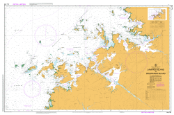
TAS 5845 – Lanka Sale
- Estimated Delivery : Up to 4 business days
- Free Shipping & Returns : On all orders over $200
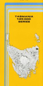
This Topographic Map is produced by the Department of Primary Industries, part of the Tasmanian Government.
These maps are an important resource for Government, industry, and the public. They are used for environmental and emergency management, farm planning and mineral exploration. They are also popular for recreational users such as bushwalkers, mountain bike and horse riders.
The PDF version of this can be printed at home or sent to a professional printer for a 100% scale reproduction.
At this scale, 4cm on this map represents 1km on the ground. A standard map (which is square) covers an area of approximately about 12.5km by 12.5km, with a contour interval of 10m. This map contains natural and constructed features including road and rail infrastructure, vegetation, hydrography, contours, localities and some administrative boundaries.
St Helens Hill Amber Creek Dorset Flats Eaglehawk Creek Bark Camp Creek Big Boggy Creek Black Creek Blowhard Creek Brooklime Creek Chung Creek Dam Hill Friend Creek Great Musselroe River Lanka Dam Little Boggy Creek Old Chum Creek Old Chum Dam Parkers Creek Pretty Marsh Pretty Marsh Hill Rattys Creek Sassafras Creek Shovel Creek Singlines Creek Snake Creek Spiders Creek Stone Chimney Creek Swain Creek Swain Hill Teddy Creek Tin Hole Creek Tin Hut Creek Blackwood Creek Lowes Creek Ruby Creek Bridge Star Hill Mine Smith Creek Great Fraser River Spurr Rivulet
| Title | Pdf Download |
|---|