TAS 5841 – Brilliant Online now
- Estimated Delivery : Up to 4 business days
- Free Shipping & Returns : On all orders over $200
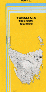
This Topographic Map is produced by the Department of Primary Industries, part of the Tasmanian Government.
These maps are an important resource for Government, industry, and the public. They are used for environmental and emergency management, farm planning and mineral exploration. They are also popular for recreational users such as bushwalkers, mountain bike and horse riders.
The PDF version of this can be printed at home or sent to a professional printer for a 100% scale reproduction.
At this scale, 4cm on this map represents 1km on the ground. A standard map (which is square) covers an area of approximately about 12.5km by 12.5km, with a contour interval of 10m. This map contains natural and constructed features including road and rail infrastructure, vegetation, hydrography, contours, localities and some administrative boundaries.
Almas Creek Avenue River Back Gully Creek Bark Hut Creek Bass Bend Beahrs Creek Berwicks Flats Big Gum Gully Big Hop Creek Break O Day Council Bridge Creek Brilliant Creek Brooks Creek Carters Creek Cartroad Gully Copper Show Ridge Evercreech Rivulet Fitzgerald Creek Granite Falls Granite Knob Greenock Creek Golden Ridge Haleys Creek Helens Marsh Holloways Creek Holloways Hill Horrible Hollow Gully Johnny Fitz Creek Kelly Creek Little Hop Creek Loila Pinnacle Loila Tier Long Bend Long Gully Creek Meadows Bend Meetings Creek Nevada Creek Nicholas Plantation Poison Gully Pyramid Hill Queen of the Earth Creek Raingauge Hill Robinsons Creek Ryans Bend Ryans Bridge Ryans Creek Sams Flat Scamander River Semmens Park Trafalgar Flat Transit Flat Treloggens Creek Upper Scamander Wolfram Creek Big Marsh Champagny Peak Evercreech Forest Reserve The Tennis Court Cato Creek
| Title | Pdf Download |
|---|