TAS 5840 – Dublin Town Cheap
- Estimated Delivery : Up to 4 business days
- Free Shipping & Returns : On all orders over $200
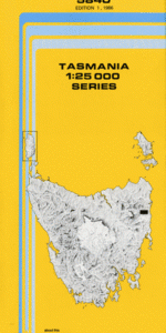
This Topographic Map is produced by the Department of Primary Industries, part of the Tasmanian Government.
These maps are an important resource for Government, industry, and the public. They are used for environmental and emergency management, farm planning and mineral exploration. They are also popular for recreational users such as bushwalkers, mountain bike and horse riders.
The PDF version of this can be printed at home or sent to a professional printer for a 100% scale reproduction.
At this scale, 4cm on this map represents 1km on the ground. A standard map (which is square) covers an area of approximately about 12.5km by 12.5km, with a contour interval of 10m. This map contains natural and constructed features including road and rail infrastructure, vegetation, hydrography, contours, localities and some administrative boundaries.
Evercreech Dublin Town Durham Creek Ballyhoo Flat Bark Creek Barnes Creek Barrows Creek Binns Creek Black Hole Black Tommys Hill Bolpeys Creek Bolpeys Ridge Catos Creek Cheeseberry Hill Coxs Creek Derricks Marsh Evercreech Sugarloaf German Town Gleadow Creek Headlams Flat Huntsmans Cap Huntsmans Creek Huntsmans Picnic Ground Marshalls Flat Mount Durham Mount Nicholas Nicholas Range North Sister Scales Creek She Oak Creek She Oak Hills Six and Twenty Falls Slab Hut Creek South Sister The Pimple Wattle Creek Webber Falls Williamsons Creek Workers Creek Avenue River Forest Reserve German Town Forest Reserve Huntsmans Cap Forest Reserve Nicholas Range Forest Reserve
| Title | Pdf Download |
|---|