TAS 5837 – St John Online Sale
- Estimated Delivery : Up to 4 business days
- Free Shipping & Returns : On all orders over $200
This Topographic Map is produced by the Department of Primary Industries, part of the Tasmanian Government.
These maps are an important resource for Government, industry, and the public. They are used for environmental and emergency management, farm planning and mineral exploration. They are also popular for recreational users such as bushwalkers, mountain bike and horse riders.
The PDF version of this can be printed at home or sent to a professional printer for a 100% scale reproduction.
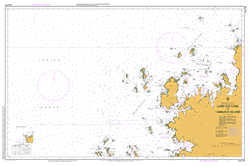
At this scale, 4cm on this map represents 1km on the ground. A standard map (which is square) covers an area of approximately about 12.5km by 12.5km, with a contour interval of 10m. This map contains natural and constructed features including road and rail infrastructure, vegetation, hydrography, contours, localities and some administrative boundaries.
Douglas River Douglas-Apsley Douglas-Apsley National Park Dry Bed Creek Barn Hill Creek Coal Marsh Coal Rivulet Cutoff Hill Denison Marshes Dickies Ridges Heritage Falls Leeaberra Falls Leechy Gully Little John Lucks Creek Lucks Lookout Mayson River Meadstone Falls Meadstone Saddle Mount Misery Mount Punter Mount Puzzler Mount St John Nowhere Else Organ Hill Pennefathers Knob Possum Creek Pratts Hill Pretty End Pretty End Creek Pretty Hills Puzzler Gorge Red Rock Rosemount Flat Smiths Tier Sunken Creek Township Flat Winsome Falls Woodheads Hill Dickies Ridge Forest Reserve Maid Mountain Mount Puzzler Forest Reserve The Gorge The Maid Mount Saint John Lewis Hill