TAS 5835 – Apslawn Discount
- Estimated Delivery : Up to 4 business days
- Free Shipping & Returns : On all orders over $200
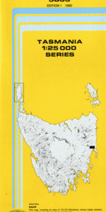
This Topographic Map is produced by the Department of Primary Industries, part of the Tasmanian Government.
These maps are an important resource for Government, industry, and the public. They are used for environmental and emergency management, farm planning and mineral exploration. They are also popular for recreational users such as bushwalkers, mountain bike and horse riders.
The PDF version of this can be printed at home or sent to a professional printer for a 100% scale reproduction.
At this scale, 4cm on this map represents 1km on the ground. A standard map (which is square) covers an area of approximately about 12.5km by 12.5km, with a contour interval of 10m. This map contains natural and constructed features including road and rail infrastructure, vegetation, hydrography, contours, localities and some administrative boundaries.
Brook Lodge Coombend Glenheriot Alfs Creek Apslawn Apslawn Bridge Apslawn Creek Apsley Marshes Big Ben Blacks Creek Boulder Creek Breakneck Creek Buster Ridge Cherry Tree Hill Cygnet Creek Freestone Creek Freestone Hill Gamble Creek Gays Creek Kazies Creek Lagoon Run Hill Murderers Hill Pine Gully Pine Hill Sassafras Gully Shaly Gully Single Plain Skeggs Hill Stingles Creek Swan River Sweetwater Creek Thicket Creek Waters Meeting Apslawn Forest Reserve Cherry Tree Hill Nature Reserve Cygnet River Forest Reserve Swan River Bridge Tea Tree Creek Top Hole Cygnet River