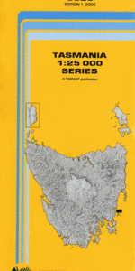
TAS 5828 – Darlington Online Hot Sale
- Estimated Delivery : Up to 4 business days
- Free Shipping & Returns : On all orders over $200
This Topographic Map is produced by the Department of Primary Industries, part of the Tasmanian Government.
These maps are an important resource for Government, industry, and the public. They are used for environmental and emergency management, farm planning and mineral exploration. They are also popular for recreational users such as bushwalkers, mountain bike and horse riders.
The PDF version of this can be printed at home or sent to a professional printer for a 100% scale reproduction.
At this scale, 4cm on this map represents 1km on the ground. A standard map (which is square) covers an area of approximately about 12.5km by 12.5km, with a contour interval of 10m. This map contains natural and constructed features including road and rail infrastructure, vegetation, hydrography, contours, localities and some administrative boundaries.
East Shelf Beaching Bay Bernacchis Creek Bird Rock Bishop and Clerk Bull Creek Buttons Bay Cape Boullanger Counsel Creek Coxswain Creek Darlington Darlington Bay Flowerpot Rocks Four Mile Beach Four Mile Creek Fossil Bay Fossil Cliffs Hopground Beach Howells Point Ile Du Nord Little Peak Magistrates Point Maria Island Marra Hill Martins Tor Monah Hill Mount Maria Mount Pedder Skipping Ridge The Club Toarra Hill Cocks Comb Copper Mines Hop Garden Valley Hopground Gully Painted Cliffs Penguin Hole Waterfall Bay Windmill Hill Isle du Nord Cape Boulanger Settlement Harbour
| Title | Pdf Download |
|---|