TAS 5827 – Riedle Sale
- Estimated Delivery : Up to 4 business days
- Free Shipping & Returns : On all orders over $200
This Topographic Map is produced by the Department of Primary Industries, part of the Tasmanian Government.
These maps are an important resource for Government, industry, and the public. They are used for environmental and emergency management, farm planning and mineral exploration. They are also popular for recreational users such as bushwalkers, mountain bike and horse riders.
The PDF version of this can be printed at home or sent to a professional printer for a 100% scale reproduction.
At this scale, 4cm on this map represents 1km on the ground. A standard map (which is square) covers an area of approximately about 12.5km by 12.5km, with a contour interval of 10m. This map contains natural and constructed features including road and rail infrastructure, vegetation, hydrography, contours, localities and some administrative boundaries.
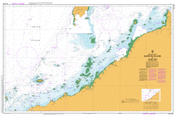
Edina Point Barren Head Big Hill Blind Creek Bloodstone Beach Bloodstone Point Booming Bay Bottom Hill Bunker Bay Calders Blowhole Cape Bald Cape Des Tombeaux Cape Maurouard Cape Peron Chinamans Bay Crooked Mcguiness Lagoon Elephant Bight Encampment Cove Greater Pyramidal Rock Green Bluff Glenloth Cliffs Goldings Reef Guards Lagoon Gulls Nest Point Haunted Bay John Bulls Rock Keyhole Lesser Pyramidal Rock Little Raggedy Head Manfern Gully Maria Island National Park McGuiness Creek McRaes Isthmus Mercury Passage Middle Hill Mistaken Cape Montgomerys Creek Ned Ryans Hill No Good Bay Oyster Bay Perons Pyramid Perpendicular Mountain Pine Hut Creek Point Lesueur Point Mauge Red Rocks Point Return Point Riedle Bay Robeys Creek Robeys Shore Robinsons Creek Shoal Bay Soldiers Beach Stinking Creek The Column Three Caverns Point Trigonia Corner Trumpeter Corner Unfortunate Cove Whalebone Point Whalers Cove Bay Of Islands Bloodstone Lagoon Boat Harbour Fox Beaches Isca Falls Ocean Beach Ragged Bay Trigonia Gully Long Point Cape Mistaken Cap des Tombeaux Cap des Trombeaux Reidle Bay Crayfish Bay Boy in the Boat
| Title | Pdf Download |
|---|