TAS 5754 – Loccota Cheap
- Estimated Delivery : Up to 4 business days
- Free Shipping & Returns : On all orders over $200
This Topographic Map is produced by the Department of Primary Industries, part of the Tasmanian Government.
These maps are an important resource for Government, industry, and the public. They are used for environmental and emergency management, farm planning and mineral exploration. They are also popular for recreational users such as bushwalkers, mountain bike and horse riders.
The PDF version of this can be printed at home or sent to a professional printer for a 100% scale reproduction.
At this scale, 4cm on this map represents 1km on the ground. A standard map (which is square) covers an area of approximately about 12.5km by 12.5km, with a contour interval of 10m. This map contains natural and constructed features including road and rail infrastructure, vegetation, hydrography, contours, localities and some administrative boundaries.
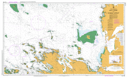
Ann Islet Barilla Point Bet Shoal Big Hollow Big River Big River Cove Buffalos Beach Butchers Peak Cronleys Creek Entrance Rock Fotheringate Bay Fotheringate Creek Franklin Sound Holts Point Kilt Shoal Little Mount Little River Loccota Lovetts Hill Mount Belstead Mount Chappell Mount Chappell Island Mount Razorback Oyster Rocks Conservation Area Peaks Of Flinders Pigs Head Point Sarah Blanche Point Sassafras Gully Strzelecki Strzelecki National Park Strzelecki Peaks Trousers Point Trousers Point Beach Trousers Bay
| Title | Pdf Download |
|---|