TAS 5721 – Tasman For Sale
- Estimated Delivery : Up to 4 business days
- Free Shipping & Returns : On all orders over $200
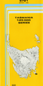
This Topographic Map is produced by the Department of Primary Industries, part of the Tasmanian Government.
These maps are an important resource for Government, industry, and the public. They are used for environmental and emergency management, farm planning and mineral exploration. They are also popular for recreational users such as bushwalkers, mountain bike and horse riders.
The PDF version of this can be printed at home or sent to a professional printer for a 100% scale reproduction.
At this scale, 4cm on this map represents 1km on the ground. A standard map (which is square) covers an area of approximately about 12.5km by 12.5km, with a contour interval of 10m. This map contains natural and constructed features including road and rail infrastructure, vegetation, hydrography, contours, localities and some administrative boundaries.
Arthurs Peak Bare Knoll Black Head Budget Head Budget Rock Calculation Hill Cape Pillar Cathedral Rock Chasm Lookout Clytie Bight Corruption Gully Crescent Mountain Desolation Gully Ellarwey Valley Haines Bight Hurricane Heath Lighthouse Lead Lunchtime Creek Mount Fortescue Munro Bight Nord Bluff Perdition Plateau Perdition Ponds Purgatory Hill Resolution Point Retakunna Creek Sheepwash Bay Snobbys Rock Tasman Island Tasman Passage The Blade The Monkeys The Oasis The Trident Tornado Flat Tornado Ridge Trident Bluff Wughalee Falls Yankee Rock Cathedral Bluff Desolation Ridge High Yellow Bluff Munroe Bight
| Title | Pdf Download |
|---|