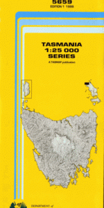
TAS 5659 – Palana Online now
- Estimated Delivery : Up to 4 business days
- Free Shipping & Returns : On all orders over $200
This Topographic Map is produced by the Department of Primary Industries, part of the Tasmanian Government.
These maps are an important resource for Government, industry, and the public. They are used for environmental and emergency management, farm planning and mineral exploration. They are also popular for recreational users such as bushwalkers, mountain bike and horse riders.
The PDF version of this can be printed at home or sent to a professional printer for a 100% scale reproduction.
At this scale, 4cm on this map represents 1km on the ground. A standard map (which is square) covers an area of approximately about 12.5km by 12.5km, with a contour interval of 10m. This map contains natural and constructed features including road and rail infrastructure, vegetation, hydrography, contours, localities and some administrative boundaries.
Sheiling The Quoin Edens Creek Blyth Bay Deep Bight Diamond Gully Furneaux Group Gossys Reef Killiecrankie Killiecrankie Bay Killiecrankie Nature Recreation … Limestone Bay Little Island Low Point Mount Blyth Mount Killiecrankie Nobbys Rock Old Mans Head Palana Palana Beach Palana Beach Nature Recreation … Possum Rock Quoin Hill Sentinel Island Stackys Bight The Dock Wingaroo Conservation Area Green Island Green Point Bligh Point Blyth Point Palana Beach Nature Recreation Area Killiecrankie Nature Recreation Area Sentinel Islet
| Title | Pdf Download |
|---|