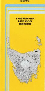
TAS 5646 – Monarch Cheap
- Estimated Delivery : Up to 4 business days
- Free Shipping & Returns : On all orders over $200
This Topographic Map is produced by the Department of Primary Industries, part of the Tasmanian Government.
These maps are an important resource for Government, industry, and the public. They are used for environmental and emergency management, farm planning and mineral exploration. They are also popular for recreational users such as bushwalkers, mountain bike and horse riders.
The PDF version of this can be printed at home or sent to a professional printer for a 100% scale reproduction.
At this scale, 4cm on this map represents 1km on the ground. A standard map (which is square) covers an area of approximately about 12.5km by 12.5km, with a contour interval of 10m. This map contains natural and constructed features including road and rail infrastructure, vegetation, hydrography, contours, localities and some administrative boundaries.
Echo Creek Echo Dam Bell Creek Bonser Creek Boundary Dam Brooks Creek Cameron Regional Reserve Campbell Creek Clarence Dam Clifton Creek Endurance Bluff Gibton Creek Gincase Creek Hardwickes Creek Hardwickes Lagoon Little Boobyalla River Conserva … Little Mount Horror Mabel Creek Monarch Dam Monarch Flats Morgans Hill Mount Cameron Sandy Creek Sapphire Creek Scrubby Creek Shallamar Creek Shallamar Flat South West Peak Talina River Vicarys Creek Waites Lagoon Wedgetail Peak Little Hill Little Boobyalla River Conservation Area
| Title | Pdf Download |
|---|