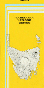
TAS 5643 – Ringarooma Online Hot Sale
- Estimated Delivery : Up to 4 business days
- Free Shipping & Returns : On all orders over $200
This Topographic Map is produced by the Department of Primary Industries, part of the Tasmanian Government.
These maps are an important resource for Government, industry, and the public. They are used for environmental and emergency management, farm planning and mineral exploration. They are also popular for recreational users such as bushwalkers, mountain bike and horse riders.
The PDF version of this can be printed at home or sent to a professional printer for a 100% scale reproduction.
At this scale, 4cm on this map represents 1km on the ground. A standard map (which is square) covers an area of approximately about 12.5km by 12.5km, with a contour interval of 10m. This map contains natural and constructed features including road and rail infrastructure, vegetation, hydrography, contours, localities and some administrative boundaries.
Mourview Cranleigh Park Hillydale Sylvania Waratah Rippledale Parklands Sea View Ringarooma Ah Foo Creek Argyle Creek Dorset River Dunstans Creek East Cascade River East Creek Auton Creek Bells Hill Bells Plains Black Jack Creek Black Rivulet Blacksmiths Hit Gully Blue Stocking Creek Blue Tier Boulder Creek Britannia Creek Cemetery Creek Come Again Creek Cook Creek Crown Prince Creek Dawn Of Hope Creek Dead Horse Hill Done Again Creek Elliott Creek Energetic Creek Exile Creek Fancy Creek George Hill Gold Creek Gorge Creek Guiding Star Creek Halfway Creek Hawkes Creek Hodges Spur Hope Creek Jessop Creek Kays Point Krushka Falls Laffer Creek Laura Creek Le Fevre Creek Legunia Maa Mon Chin Dam Maggs Creek McIntyre Creek Merrin Creek Mineral Banks Creek Moon Creek Mount Paris Mount Paris Dam Nelson Creek New River North George River North View Creek Nuggety Creek Paynes Bridge Pearce Creek Pera Flats Rattler Creek Rattler Hill Rattler Range Rio Grande Creek Sarah Ann Creek Sea View Hill Smith Creek Spinel Creek Star Of Peace Plantation Stony Creek Try Again Creek Union Jack Creek Weldborough Weldborough Pass White Creek Bells Rainforest Deep Creek Main Creek Rainforest North George Rainforest Pinega Ringarooma River Bridge Spinel Rainforest Spinel Halfway Weld Creek Bridge Alberton
| Title | Pdf Download |
|---|