TAS 5636 – Roys Online now
- Estimated Delivery : Up to 4 business days
- Free Shipping & Returns : On all orders over $200
This Topographic Map is produced by the Department of Primary Industries, part of the Tasmanian Government.
These maps are an important resource for Government, industry, and the public. They are used for environmental and emergency management, farm planning and mineral exploration. They are also popular for recreational users such as bushwalkers, mountain bike and horse riders.
The PDF version of this can be printed at home or sent to a professional printer for a 100% scale reproduction.
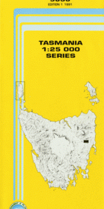
At this scale, 4cm on this map represents 1km on the ground. A standard map (which is square) covers an area of approximately about 12.5km by 12.5km, with a contour interval of 10m. This map contains natural and constructed features including road and rail infrastructure, vegetation, hydrography, contours, localities and some administrative boundaries.
Royslea Rock House Snow Hill Benham Plains Brushy Hill Burnt Hill Campbells Hill Colemans Gully Deer Hill Doctor Levers Head Fitzallen Creek Fog Hill Gibsons Hill Hepburn Creek Jam Creek Jelly Creek Lewis Hill Lewis Hill Creek McGees Marsh Murrays Hill Peppertree Marsh Pole Creek Rifle Point Robins Lawn Hill Rockhouse Creek Royal George Roys Hill Roys Hill Creek School Creek Snow Hill Marshes Splitters Gully St Pauls Plains Stable Creek Stag Hill White Marsh White Rock Bluff Adams Hollow Bald Hill Royal George Forest Reserve Snow Hill Forest Reserve The Razorback The Sisters
| Title | Pdf Download |
|---|