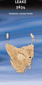
TAS 5634 – Leake Online
- Estimated Delivery : Up to 4 business days
- Free Shipping & Returns : On all orders over $200
This Topographic Map is produced by the Department of Primary Industries, part of the Tasmanian Government.
These maps are an important resource for Government, industry, and the public. They are used for environmental and emergency management, farm planning and mineral exploration. They are also popular for recreational users such as bushwalkers, mountain bike and horse riders.
The PDF version of this can be printed at home or sent to a professional printer for a 100% scale reproduction.
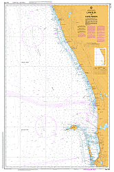
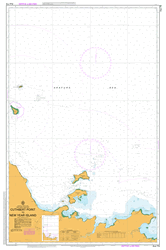
At this scale, 4cm on this map represents 1km on the ground. A standard map (which is square) covers an area of approximately about 12.5km by 12.5km, with a contour interval of 10m. This map contains natural and constructed features including road and rail infrastructure, vegetation, hydrography, contours, localities and some administrative boundaries.
Eagle Ridge Badger Hill Bald Ridge Bellevue Island Big Bedding Hill Big Peppermint Hill Big Spit Big Timber Shore Block and Stable Creek Boathole Brodribb Creek Chock n Log Bay Clarks Point Coghlans Point Crossing Hill Cutting Grass Bay Flatrock Hill Gallows Point Garwoods Creek Gibson Point Giles Creek Giles Sugarloaf Hallam Cave Creek Hobgoblin Hortons Creek Kalangadoo Bay Ladies Mile Marsh Lake Leake Lake Yalleena Little Spit Lost Falls Lost Falls Creek March Island Mount Connection Nichols Point O Briens Point Old Flagstaff Marsh Parramores Creek Parramores Swamp Parramores Tier Rawlinna Rawlinna Hill Red Beach Rocky Rivulet Shaws Bogs Snake Rock Spencers Point Stonehouse Bridge Swamp Bay Wet Gun Swamp Wingys Tier Wye River Wye River Conservation Area Wye River State Reserve Wyefield Rivulet Bullock Paddock Creek Castor Oil Bottle Hortons Creek Bridge Lost Falls Forest Reserve
| Title | Pdf Download |
|---|