TAS 5632 – Tooms on Sale
- Estimated Delivery : Up to 4 business days
- Free Shipping & Returns : On all orders over $200
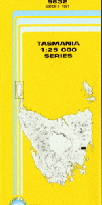
This Topographic Map is produced by the Department of Primary Industries, part of the Tasmanian Government.
These maps are an important resource for Government, industry, and the public. They are used for environmental and emergency management, farm planning and mineral exploration. They are also popular for recreational users such as bushwalkers, mountain bike and horse riders.
The PDF version of this can be printed at home or sent to a professional printer for a 100% scale reproduction.
At this scale, 4cm on this map represents 1km on the ground. A standard map (which is square) covers an area of approximately about 12.5km by 12.5km, with a contour interval of 10m. This map contains natural and constructed features including road and rail infrastructure, vegetation, hydrography, contours, localities and some administrative boundaries.
Alfred Creek Anglers Creek Axe Handle Bay Barren Joey Ridge Bedfords Sugarloaf Breasted Sugarloaf Buxton River Buxtons Lookout Chicken Creek Citizen Ridge Clarkes Hill Clemmys Creek Daylight Hill Devil Trap Creek Diamond Tier Dogholes Creek Flagstaff Marsh Green Tier Goanna Hill Grahams Creek Groves Point Halls Bay Iron Rocks Shore Jimmys Creek Jimmys Marsh Kafoozalum Creek Kafoozalum Ridge Killora Creek Mitchells Creek Moaners Tier Mount Lofty Mount Tooms Rainbow Point Slaters Bay Stoneyard Hill Tooms Lake Tooms River Watch House Bay Webbs Hill Wet Bay White Rocks Shore Asthmatic Creek Bedfords Tier Boags Creek Boundary Ridge Buxton River Forest Reserve Caustic Creek Chimney Creek Chipmans Lookout Claretcup Creek Cobblestone Creek Commencement Ridge Confusion Creek Contour Creek Corner Swamp Cosmetic Creek Crib Creek Curly Creek Cutaway Hill Duck Swamp Facility Spur Halls Ridge Hut Ridge James Creek Joey Swamp Kakariki Creek Kallista Creek Kangaroo Ground Mount Miraculous Musterers Marsh Outlook Hill Rainbow Creek South Ramble River Sugarloaf Swamp Swanshaven Swamp Tooms Lake Forest Reserve Tooms White Gum Forest Reserve Williams Creek North Macquarie River
| Title | Pdf Download |
|---|