TAS 5237 – Cleveland Cheap
- Estimated Delivery : Up to 4 business days
- Free Shipping & Returns : On all orders over $200
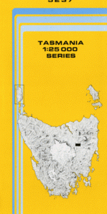
This Topographic Map is produced by the Department of Primary Industries, part of the Tasmanian Government.
These maps are an important resource for Government, industry, and the public. They are used for environmental and emergency management, farm planning and mineral exploration. They are also popular for recreational users such as bushwalkers, mountain bike and horse riders.
The PDF version of this can be printed at home or sent to a professional printer for a 100% scale reproduction.
At this scale, 4cm on this map represents 1km on the ground. A standard map (which is square) covers an area of approximately about 12.5km by 12.5km, with a contour interval of 10m. This map contains natural and constructed features including road and rail infrastructure, vegetation, hydrography, contours, localities and some administrative boundaries.
Fairfield Midwood Esk Vale Glasslough Belle Vue Clyne Vale Kallattie Woorak Vaucluse Valleyfield Forest Hall Inglewood Bostock Hill Cleveland Cleveland Lagoon Coles Ford Dicks Banks Diprose Lagoon Epping Forest Glen Esk Bridge Lincoln Lagoon Middle Run Hill Northern Midlands Council Smiths Lagoon Stewarton Bridge Tom Gibson Nature Reserve Vaucluse Reservoir Round Marsh Epping Isis River