TAS 5025 – Collinsvale For Sale
- Estimated Delivery : Up to 4 business days
- Free Shipping & Returns : On all orders over $200
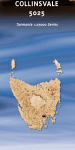
This Topographic Map is produced by the Department of Primary Industries, part of the Tasmanian Government.
These maps are an important resource for Government, industry, and the public. They are used for environmental and emergency management, farm planning and mineral exploration. They are also popular for recreational users such as bushwalkers, mountain bike and horse riders.
The PDF version of this can be printed at home or sent to a professional printer for a 100% scale reproduction.
At this scale, 4cm on this map represents 1km on the ground. A standard map (which is square) covers an area of approximately about 12.5km by 12.5km, with a contour interval of 10m. This map contains natural and constructed features including road and rail infrastructure, vegetation, hydrography, contours, localities and some administrative boundaries.
Cotswold Brookside Blackhall Bottom Willow Creek Ringwood Hamel Alpine Rose Collinsvale Appeldorff Creek Big Rocky Black Glen Briers Creek Brinckmans Ridge Collins Bonnet Collins Cap Crocodile Rock Dead Island Devils Throne Elwick Fairy Glen Flagstone Rivulet Fools Tarn Fryingpan Hills Georges Flagland Glenlusk Glenorchy City Council Goat Hills Gumtop Ice Brook Illa Brook Illa Brook Reservoir Knights Creek Knights Creek Reservoir Lachlan Little Rocky Littlejohn Creek Long Marsh Lost World Middle Hill Midsky Swamp Montagu Creek Mount Arthur Mount Charles Mount Connection Mount Hull Mount Marian Mount Patrick Mount Wellington Murdochs Hill Myrtle Forest Creek Myrtle Forest Falls Myrtle Forest Picnic Area New Town Falls Oak Hill Oneys Creek Organ Pipes Pond Plain Pulpit Rock Richards Monument Roaring Creek Rocking Stone Silver Falls Silver Falls Creek Sleeping Beauty Sphinx Rock Springdale Stinging Nettle Gully Swamp Gum Creek Thark Ridge The Backbone The Lectern The Slips Timbs Reserve Tom Thumb Trestle Mountain Wellington Park White Timber Mountain Yellow Cliffs Boars Back Rocky Joe Shoobridge Bend The Pinnacle Tommy Obbleys Hole Glenfern Glebe Rivulet Myrtle Falls Creek Flinders Montaigne du Plateau Mount Table Pooranetteri Skiddaw Unghanyahletta
| Title | Pdf Download |
|---|