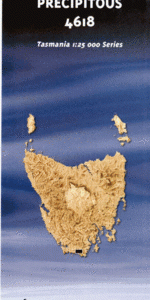
TAS 4618 – Precipitous For Cheap
- Estimated Delivery : Up to 4 business days
- Free Shipping & Returns : On all orders over $200
This Topographic Map is produced by the Department of Primary Industries, part of the Tasmanian Government.
These maps are an important resource for Government, industry, and the public. They are used for environmental and emergency management, farm planning and mineral exploration. They are also popular for recreational users such as bushwalkers, mountain bike and horse riders.
The PDF version of this can be printed at home or sent to a professional printer for a 100% scale reproduction.
At this scale, 4cm on this map represents 1km on the ground. A standard map (which is square) covers an area of approximately about 12.5km by 12.5km, with a contour interval of 10m. This map contains natural and constructed features including road and rail infrastructure, vegetation, hydrography, contours, localities and some administrative boundaries.
Arndell Falls Chapman Creek Damper Cave Damper Creek Deadmans Creek Elusive Bluff Grotto Creek Kameruka Moraine King Billy Saddle Knife Mountain Lake Mountain Leaning Tea Tree Saddle Limestone Creek Malani Creek Maxwell Ridge McKays Creek Menzies Bluff Moonlight Ridge Moores Bridge Mount La Perouse Mount Victoria Cross Mount Wylly New River Lagoon Ooze Lake Oval Lake Pandani Knob Peuniak Cave Pigsty Ponds Pindars Peak Precipitous Bluff Prion Bay Prion Beach Quetzalcoatl Conduit Reservoir Lakes Swallows Nest Lakes The Cockscomb Turua Beach Urquhart Creek Catamaran Cirque D Entrecasteaux Cirque Glacial Shelf Hill Four Hill Three Hill Two La Perouse Valley Lake Wolcot Lune Cirque Lune Gorge Pendare Peak New River Bay
| Title | Pdf Download |
|---|