TAS 4441 – Sheffield Online now
- Estimated Delivery : Up to 4 business days
- Free Shipping & Returns : On all orders over $200
This Topographic Map is produced by the Department of Primary Industries, part of the Tasmanian Government.
These maps are an important resource for Government, industry, and the public. They are used for environmental and emergency management, farm planning and mineral exploration. They are also popular for recreational users such as bushwalkers, mountain bike and horse riders.
The PDF version of this can be printed at home or sent to a professional printer for a 100% scale reproduction.
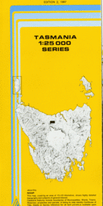
At this scale, 4cm on this map represents 1km on the ground. A standard map (which is square) covers an area of approximately about 12.5km by 12.5km, with a contour interval of 10m. This map contains natural and constructed features including road and rail infrastructure, vegetation, hydrography, contours, localities and some administrative boundaries.
Gaythorpe Oakleigh Selika Burnside Fairview Craiglea Hollyhill Glenchy Roland Vale Clydebanks Harland Rise Sheffield Duck Marsh Dynans Bridge Badgers Plantation Beulah Beulah Plantation Blackberry Hill Bryans Bridge Coilers Creek Conglomerate Hill Dasher Falls Dasher River Dasher River Conservation Area Dawkins Hill Dodder Rivulet Hot Water Rivulet Kimberley Kimberley Springs Kimberley Springs State Reserve King George Park Lizard Hill Loafer Creek Lowes Bridge Lowes Creek Minnow River Moltema Panorama Sugarloaf Paradise Richland Hill Romani Hill Stanley Creek Stave Creek Stoodley Stoodley Plantation Sun Ridge Sunnyside Tinpot Creek Vinegar Hill Weegena August Plain Brook Head Dasher River Bridge Don River Bridge Duckmarsh Bush Kentish Plains Lizard Hill Forest Reserve Storehouse Plain Kentish Coiler Creek Claude Road
| Title | Pdf Download |
|---|