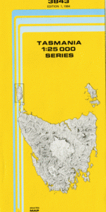
TAS 3843 – Tewkesbury Fashion
- Estimated Delivery : Up to 4 business days
- Free Shipping & Returns : On all orders over $200
This Topographic Map is produced by the Department of Primary Industries, part of the Tasmanian Government.
These maps are an important resource for Government, industry, and the public. They are used for environmental and emergency management, farm planning and mineral exploration. They are also popular for recreational users such as bushwalkers, mountain bike and horse riders.
The PDF version of this can be printed at home or sent to a professional printer for a 100% scale reproduction.
At this scale, 4cm on this map represents 1km on the ground. A standard map (which is square) covers an area of approximately about 12.5km by 12.5km, with a contour interval of 10m. This map contains natural and constructed features including road and rail infrastructure, vegetation, hydrography, contours, localities and some administrative boundaries.
Emu Vale Farm Douglas Brook East Cam River East Cam River Conservation Area Broadridge Coast View Hill Deacon Creek Gotopeak Hill Guide Reservoir Guide River Hampshire Hellyer Gorge Highclere Highclere Siding Messengers Flat Mount Leslie Nolans Hill Oonah Oonah Plantation Paddy Sugarloaf Porcupine Creek Scolyers Hill Silvermine Creek Snowdon Plains St Josephs Falls St Josephs River St Marys Plains St Marys River Tewkesbury Three Brook Plain Trout Rivulet Upper Guide Falls Western Plain Wollastonite Creek Broadridge Plain Deep Creek Douglas Bush Foster Falls Granite Rock Hellyer River Bridge Hellyer Trig Nine Mile Forest Saddle Plain Sisters Hills Temperance Plain Valley Plains Takone River Saint Mary
| Title | Pdf Download |
|---|