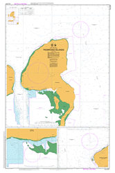
PNG 637 – Trobriand Islands Discount
- Estimated Delivery : Up to 4 business days
- Free Shipping & Returns : On all orders over $200
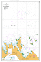
This official Nautical Chart is produced by the Australian Hydrographic Office, and corrected fortnightly to Notice to Marines by Cairns Charts & Maps. This ensures it remains compliance with Safety of Navigation requirements. This marine chart, or sea map , is primarily produced to support the safe navigation of commercial shipping through Australian, Papua New Guinea and Solomon Island waters.
Nautical charts depict the seabed, or bathymetry, using a variety of colours to shade the depth regions. Darker blues indicate shallower water, while light blues and white indicate deeper water. A chart will also show continuous contour lines (at varying intervals depending on the scale of the chart), spot depths across the whole area, as well as different symbols indicating wrecks, shallow rocks and dangers, as well as details on lights, light houses, tides and currents.
For extensive detail on the symbology of nautical charts, the Symbols and Abbreviations used on Admiralty Charts is the definitive reference.
Yalaka Yalaki Wagwama Bay Towai Point Tawai Point Taiagaina Bay Taiagina Bay Sia Islet Sia Island Okupukopu Creek Obulaku Obulaka Oburaka Muiau Bay Muaio Bay Muiao Bay Moligilagi Moligilaga Miligui Point Mamamada Point Mamada Point Magulata Point Losuia LSA Lobua Creek Kwaibwaga Kumkuri Point Kuluvitu Kuluritu Koseikwa Point Kosesikwa Point Koma Kiriwana Karakuba Point Kaileuna Island Kaibola Kadataiveakwa Point Kadalaiveakwa Point Kadalawa Point Kabwao Point Kabuluna Point Idateka Point Bugeew Point Bugeewa Point Idaleka Point Ialaka Bomatu Point Bamatu Point Cape Denis Bomapau Island Baimapu Island Illasasa Boli Point Boitalu Beitalu Losuia Airport AYKA Tukwaukwa Okukwewelou Kiriwina Goodenough Kiriwina Goodenough District Kiriwina-Goodenough Kiriwina-Goodenough District
| Title | Paper, Flat Paper, Laminated |
|---|
