PNG 519 – Ward Hunt Strait To Star Reefs Passage For Discount
- Estimated Delivery : Up to 4 business days
- Free Shipping & Returns : On all orders over $200
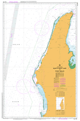
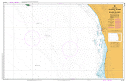
This official Nautical Chart is produced by the Australian Hydrographic Office, and corrected fortnightly to Notice to Marines by Cairns Charts & Maps. This ensures it remains compliance with Safety of Navigation requirements. This marine chart, or sea map , is primarily produced to support the safe navigation of commercial shipping through Australian, Papua New Guinea and Solomon Island waters.
Nautical charts depict the seabed, or bathymetry, using a variety of colours to shade the depth regions. Darker blues indicate shallower water, while light blues and white indicate deeper water. A chart will also show continuous contour lines (at varying intervals depending on the scale of the chart), spot depths across the whole area, as well as different symbols indicating wrecks, shallow rocks and dangers, as well as details on lights, light houses, tides and currents.
For extensive detail on the symbology of nautical charts, the Symbols and Abbreviations used on Admiralty Charts is the definitive reference.
Yeimi Creek Woruka Cape Womobu Awanavea Point Wauna River Ward Hunt Strait Wamsia Point Wabubu Island Vineuo Mount Oiautukekea Mount Vineuo Veale Reef Cape Varieta Varau Island Brimaikoroto Island Gowlland Island Uramanoa Bay Urumanoa Bay Tumatumabi Tufi Harbour Tufi TFI Tototo Timota Creek Tawanaguna Bay Tatala Tapiosan Tapio Bay Tapio Tapio Mission Tainabuna Stewart Reefs Siu Sirimo Sinipara Island Hardy Island Sinapara Island Silaliba Bay Sidney Islands Siata Island Sefoa Sefoa Mission Sepoa Mission Rothwell Bank Cape Rawlinson Rausewa Rakua 2 Rakua Rakua River Fir Tree Creek Lakuo River Rakua Point Rabadi Posa Posa Harbour Posi Posi Habour Pusi Pusi Harbour Pem Mission Pem Orotoaba Oparea Island Onare Island Nuama Islet Luamata Island Naame Island Mwananoia Muwa Rock Muwa Point Mukawa Mission Mukawa Mokaua Moratau Moi Biri Bay Midino Creek Midino Medino Medino Mission Mayoman Mission Masubuna Bay Masabuna Bay Masusuna Bay Marua Point Marua Creek Marua Magabara Maclaren Harbour Kofulu Harbour Macharen Harbour Mabuwa Lilioa Leaga Larikuku Bay Cape Lahaye Poponawe Point Kwinimeba Creek Kwagila River Kwagira River Kwagila Kwagira Kuririka Kupari Point Sefoa Point Konokonowana Island Konokonwana Konedobu Koje Kibirisi Point Kewansasap Kenwasasape Kewanasap Kewanasap Mission Kewansasap Mission Kewasasap Keast Reef Kasiawa Karuasi Karuasi Mission Kanawetu Kanaweto Kanapu Island Kanapo Kakaweadiaeia Kai-Yo Bay Kairaga Islet Kairago Island Kariwa Jebo Jarrad Islands Jabbering Islands Itoi Creek Ipoteto Island Ikara Island Ipotete Island Kara Island Ibura Bay Iarame Yarame Hilda Islands Hardy Point Ham Reef Hall Point Gwadarab Island Guruga Creek Guru Greaves Reef Goipat River Ginum Creek Gera Gera Sina Cera Gera Sina Gera Gera Sino Gegerau Garana Creek Garand Creek Gaiewa Gabwina Island Gadwina Island Foduma Fir Tree Point Fig Tree Point Feiaba Bay Dudububuna Bay Diodio Debonefue Debenefue Dart Reefs Dart Reef Dark Hill Point Dark Hill Dabi River Cone Peak Button Island Buburia Buberia Buburira Buberin Waibula Buali Waibula Boga Boga Mission Black Rocks Batua Barabara Baiawa Baga Amiuan Bay Amuian Bay Biteabout Harbour Ailok Creek Tufi Airport AYTU Lifaba Island Kudalabi Island Auwale Augana Ufaufa