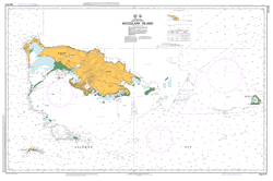
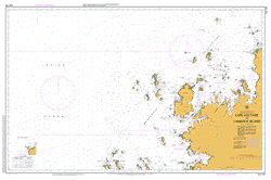
PNG 514 – Woodlark Island For Cheap
- Estimated Delivery : Up to 4 business days
- Free Shipping & Returns : On all orders over $200
This official Nautical Chart is produced by the Australian Hydrographic Office, and corrected fortnightly to Notice to Marines by Cairns Charts & Maps. This ensures it remains compliance with Safety of Navigation requirements. This marine chart, or sea map , is primarily produced to support the safe navigation of commercial shipping through Australian, Papua New Guinea and Solomon Island waters.
Nautical charts depict the seabed, or bathymetry, using a variety of colours to shade the depth regions. Darker blues indicate shallower water, while light blues and white indicate deeper water. A chart will also show continuous contour lines (at varying intervals depending on the scale of the chart), spot depths across the whole area, as well as different symbols indicating wrecks, shallow rocks and dangers, as well as details on lights, light houses, tides and currents.
For extensive detail on the symbology of nautical charts, the Symbols and Abbreviations used on Admiralty Charts is the definitive reference.
Laughlan Atoll Budibudi Islands Laughlan Islands Nada Islands Wonai Bay Woni Bay Whasela Point West Entrance Waspimat Bay Wasimu Island Wasima Wabununu Wabunuma Wabununa Wabomat Island Lisilus Island Utani Vaviai Island Vavi ai Unkinbod Bay Tokona Island Takora Island Takoro Island Suloga Point Suloga Peak Suloga Harbour Steep Point Sinkurai River Shoute Point Sharp Island Picnic Point Oquana Point Oburak Island Oksupan Nusam Island Nosam Island Nubara Island Nasai Island Quarantine Island Muyua Island Mujua Murua Woodlark Island Mapas Island Main Point Madau Island Madau Lufuai River Losuia District Kwaiapan Bay Kwarapan Bay Kumarau Bay Kulumadau Kaurai Lagoon Kaurai Mount Kabat Mount Kabati Halfway Rock Guasopa Harbour Guasopa Bay Guasopa GAZ Guasop Ginetu Island Direction Point Dikoias Decoyas Cannac Island Cam Point Buyuasi Bay Buyuesi Bay Richards Bay Bukulan Island Bugulan Budelun Island Bonivat Bonagai Bomasea Bamaseu Boagis Passage Boagis Pass Boagis Bugis Alcester Islands Alcester Island Nasikuab Island Aiun Aiona Island Round Island AYGJ Kam Munieyova Digdagela Kauwai Loanai Plantation Kropan Lake Lalua Nanon Island Ginada Island Kudul Point Munkai River Kavatana Gumsupwan Point Bulaya Point Wabulak Island Tamians Reef Tamian s Reef
| Title | Paper, Flat Paper, Laminated |
|---|
