GA 9576 – Panatinane on Sale
- Estimated Delivery : Up to 4 business days
- Free Shipping & Returns : On all orders over $200
This Topographic Map is produced by Geoscience Australia; Australia s national geospatial organisation.
GA topographic maps (many of which are produced in partnership with the Army) are generally older than those maps produced by the State Governments over the same area. This makes GA maps particularly useful for identifying historic features, such as old mines and diggings.
Geoscience Australia maps generally considered to be more pleasing in design and compilation then the more modern State Government productions.
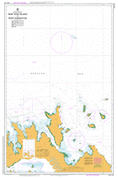
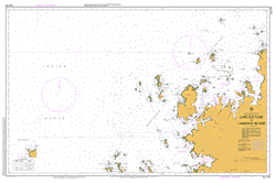
At this scale, 1cm on this map represents 1km on the ground. A standard map (which is square) covers an area of approximately 54km by 54km, with a contour interval of 20m. This map contains natural and constructed features including road and rail infrastructure, vegetation, hydrography, contours, localities and some administrative boundaries.
Please note the date of the map, as this will impact the currency of information, particularly regarding infrastructure, roads, etc.
Topuna Sabari Island Owen Stanley Island Pudsey Rock Pipidai Point Pei I Point Pana-Wina Island Kaluma Island Pana Tinani Island Joannet Island Pana Kuba Islet Owen Stanley Bank Oreia Islet Oreia Island Niva Beno Islet Nivabeno Island Nirut Misima District Manuga Reefs Manbuan Point Maga Maga Passage Mabui Islet Mabui Island Louisiade Archipelago Imadi Bay Hudumu Iwa Passage Bramble Pass Hiscock Reef Heva Isi Islet Heva Isi Island Hessessai Bay Hemenahei Island Flat Island Hemenahehi Island Hei Oyo Point Mount Heibuk Hauagili Point Hanagili Point Hanover Rock Mount Guyuba Guyuba Mountain Gawn Point Galley Rock Fisher Reef Feu de Joie Anchorage Epoko Islet Epoko Island Chubudi Passage Buvara Bay North West Bay Bushy Islet Bridge Shoals Bounce Point Boiama Point Blind Rock Beagle Rock Gudau Peninsula Tandeyai Hekampan Niyalehoi Nigaho Island Hobuk Lalahaiwa Islands Ninisova
| Title | Paper, Laminated |
|---|