GA 8183 – Aseki Online Hot Sale
- Estimated Delivery : Up to 4 business days
- Free Shipping & Returns : On all orders over $200
This Topographic Map is produced by Geoscience Australia; Australia s national geospatial organisation.
GA topographic maps (many of which are produced in partnership with the Army) are generally older than those maps produced by the State Governments over the same area. This makes GA maps particularly useful for identifying historic features, such as old mines and diggings.
Geoscience Australia maps generally considered to be more pleasing in design and compilation then the more modern State Government productions.
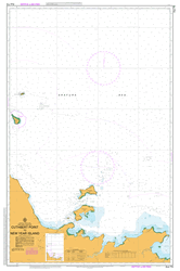
At this scale, 1cm on this map represents 1km on the ground. A standard map (which is square) covers an area of approximately 54km by 54km, with a contour interval of 20m. This map contains natural and constructed features including road and rail infrastructure, vegetation, hydrography, contours, localities and some administrative boundaries.
Please note the date of the map, as this will impact the currency of information, particularly regarding infrastructure, roads, etc.
Yinimba Yeiweni Yeggie Yakwoi River Yakitanwa Yakitangwa Yagepa Yabona Yaa-Didimanga Didimanga Yaa Winga Windowi Wiama Number 2 Wiama Wiama 2 Wempangu Wawbini Wawapini Wauwoga Wapalala Wandini Umdamna Tobaigo Titauwawi Towedo Timbertop Mountain Mount Taylor Mount Taylour Tauinni Tau inni Tauvani Tamoi Tamoi Taupa Sugawianga Spreader Divide Mount Sloane Sikwong Shonhau Shon hau Sapanda Rock Lookout Poiyu Piwianga Piwi anga Pingamunga Pinamanga Peisu Pauamunga Gumna Passaia Panganda Mountain Ondatera Oiwa Nenewe Neietnda Neiet nda Nanitmar River Mungo Mouini Mingia Menyi Menyamya Menyamya District MYX Menyamya Villages Menya Mekini Mount McLean Mount Leahy Langimar River Kwietta Kwasimerga Kwandagogi Kwondagogi Kwampiang Mount Kwaimunga Mount Kwaihinango Kwagaga Kwadungwi Yeiwia Kukukuku Ranges Kotidanga Mount Kosh Korteio Kornade Komagowatta Koki Kieta Kekewana Mount Kamhiayer Kalasu Kaintiba KZF Kaingo Kabong Kabakini Kobakini Iwatimna Iwatimnga Ikyaua Iki awa Ikiawa Mount Ikornadunga Mount Ibini Mount Imbini Iagobei Himerka Hiakwoto Hiakwata Hengeiapa Rest House Hawaweto Hauwiawieto Hawata Hawate Hauwambanga Hauwabanga Hamuni Hamuini Hambia Hambie Gumi Creek Gumi Gumana Mount Grosse Gemantua Mount Evina Etobanga Epinati Creek Ekuti Dividing Range Eiba Dokuta Benula Bema Mission Bakia Bainnu Bain nu Aweaka Awaiepa Atapaura Aseki AEK Aringi Arifogo Arifogo Awai epa Arifogo Awaiepa Suiakndi Aningi Angweta Angwieta Anggaie Angeiwunga Angeiwanga Angabena Andandora Anandor Anandaua Akwanje Akwangi Aiwamba Aiuwo Aiogwei Aiogi Agaganda Langimar LNM Heiweni HNI Tawa TWY Yegepa PGE Uyakoji Dambi Otete Yangaiya Tangiawa Piawini Aseki Airport AYAX
| Title | Paper, Laminated |
|---|