GA 7882 – Deception Hot on Sale
- Estimated Delivery : Up to 4 business days
- Free Shipping & Returns : On all orders over $200
This Topographic Map is produced by Geoscience Australia; Australia s national geospatial organisation.
GA topographic maps (many of which are produced in partnership with the Army) are generally older than those maps produced by the State Governments over the same area. This makes GA maps particularly useful for identifying historic features, such as old mines and diggings.
Geoscience Australia maps generally considered to be more pleasing in design and compilation then the more modern State Government productions.
At this scale, 1cm on this map represents 1km on the ground. A standard map (which is square) covers an area of approximately 54km by 54km, with a contour interval of 20m. This map contains natural and constructed features including road and rail infrastructure, vegetation, hydrography, contours, localities and some administrative boundaries.
Please note the date of the map, as this will impact the currency of information, particularly regarding infrastructure, roads, etc.
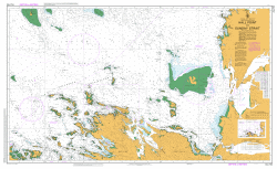
Waruka Creek Wapo River Wami Point Wame Point Wame River Veraibari Varaibari Varoi River Baroi River Uramu Island Urama Island Urama Creek Uramu Creek Tovei Saumao Peninsula Romilly Sawmill Port Romilly Romilly Purari Delta Puari Delta Plum Point Pie River Kanaina Kapaina River Pai-A Point Pai-A Inlet Omaumere Old Kamaua Old Kamau a Kamaua Moravamu Mirimairau Mira Point Miri Point Mira Maripepea Mairipepea Marikimiro Point Mariki Maiara Maiaki Koravaki Koiravi Apiravi Koivari Kivaumai Number 2 Kivaumai 2 Kivaumai Number 1 Kivaumai 1 Kinomere Kinipo Kinipu Kauravi Karimia Kapuna Kaivu Kairimai Kaimari Island Kaimari Kaimare Kaimare Creek Kaimari Creek Kaiaravi A-ki-ravi Ivo River Kairu River Ivi River Tiviri River Iviri Inlet Ivira Inlet Ini Island Evara Evarra Era River Era Bay Deception Bay Damaibari Cape Blackwood Beara Barea Baroi Baru River Boru River Varia Bapai Point Bald Head Awamu Creek Avioua Araava Ara ava Aibigai Aiai River Aird River Delta Gully Bank Wabo WAO
| Title | Paper, Laminated |
|---|