GA 7487 – Urei Sale
- Estimated Delivery : Up to 4 business days
- Free Shipping & Returns : On all orders over $200
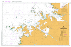
This Topographic Map is produced by Geoscience Australia; Australia s national geospatial organisation.
GA topographic maps (many of which are produced in partnership with the Army) are generally older than those maps produced by the State Governments over the same area. This makes GA maps particularly useful for identifying historic features, such as old mines and diggings.
Geoscience Australia maps generally considered to be more pleasing in design and compilation then the more modern State Government productions.
At this scale, 1cm on this map represents 1km on the ground. A standard map (which is square) covers an area of approximately 54km by 54km, with a contour interval of 20m. This map contains natural and constructed features including road and rail infrastructure, vegetation, hydrography, contours, localities and some administrative boundaries.
Please note the date of the map, as this will impact the currency of information, particularly regarding infrastructure, roads, etc.
Yamberei Yagato River Wasiba River Waruni Mount Wabu Urubwa River Urei River Ive Urei Sumbasu River Roesicke Mountain Porgera District Mount Pauuwa Paru River Paiela River Pagia River Orei McNicoll Mountains Mount Mano Mairo River Logaiyu River Ive Logaiyu Logatyu River Mount Kuruba Mount Kumbivera Kopiago District Koia River Mount Kinai Kauri Lake Kaiano Ivoru River Fuguma River Bornega Mountain Aruma River Mount Aiagu Paiela Airport PLE Pundami Peragoia Pori River Koroba-Lake Kopiago Koroba Lake Kopiago District Koroba-Kopiago Koroba-Lake Koipiago Koroba-Lake Kopiago District Paiela
| Title | Paper, Laminated |
|---|