-
$115 $57.50
This edition 100 Magic Miles represents the latest, up-to-date information on the islands and anchorages of the Whitsundays, including the introduction of many additional moorings, and on steps to further protect the coral reefs of the area. Details are given on the re-opened Hayman Island and Daydream Island resorts and a new boutique resort at…
-
$59.95 $29.98
The Anchorage Guide: Cairns to Darwin is a comprehensive guide to the anchorages along the Queensland and Northern Territory coastline, stating at Fitzroy Island off Cairns and finishing at the Daly River north of Darwin. Incorporating satellite imagery, clear descriptions and simply symbology; this guide is focused on giving the reader confidence as to which…
-
$105 $52.50
The Australian Boating Manual is the first handbook and reference manual of such comprehensive magnitude to be published in Australia. Everyone who has anything to do with boating will find this hard cover 1000-page publication, which also contains over 3000 questions and answers, an indispensable textbook and reference manual. This publication includes: Buying and insuring…
-
$135 $67.50
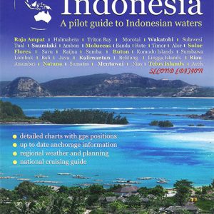
With 18,000 isles covering some two million square miles of pristine tropical water and a rich and vibrant local culture there truly can be no comparison. Cruising Guide to Indonesia covers everything the prudent navigator needs to safely ply the Indonesian waters and enjoy the largest and best island nation in the world. The second…
-
$100 $50
First published in 1968, Alan Lucas’ Cruising the Coral Coast has long been considered the bible for cruising the Queensland coast. Significant detail is provided of anchorages along the coast with detailed maps, approach recommendations, tides, anchorage recommendations, moorings and marinas berths, facilities as well as points of interest. Currents, tides and weather are all…
-
$100 $50
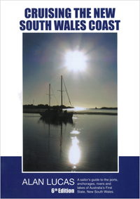
First released in 1976, this is the sixth edition of Cruising the New South Wales Coast. Surveyed and produced aboard the author s vessel Soleares, it describes the entire coast between the Victorian and Queensland borders including all navigable rivers, many well beyond their first fixed bridge for the benefit of those with motor boats,…
-
$68 $34
Essential for all mariners using Admiralty charts (both paper and ARCS), this publication illustrates Symbols and Abbreviations in full colour, along with full explanations. The publication also contains information on hydrography, topography and navigational aids and services.
-
$68 $34
The companion to NP5011, intended to be used both as a training aid and as a reference during passage planning and navigation, this guide contains comprehensive information relating to ENC symbols. The publication provides graphics showing both the traditional and the simplified forms of symbols, as well as descriptions of the use of the symbol…
-
$11.95 $5.98
The Queensland Tide Tables are the go to reference for the tides anywhere in Queensland. Whether you are fishing or boating, this handy A5 sized book, is a must have reference. Daily high and low water heights and times for over 30 locations along the Queensland coast are published in a traditional and easily understood…
-
$12.95 $6.48
The Queensland Tide Tables are the go to reference for the tides anywhere in Queensland. Whether you are fishing or boating, this handy A5 sized book, is a must have reference. Daily high and low water heights and times for over 30 locations along the Queensland coast are published in a traditional and easily understood…
-
$69.95 $34.98
Rob’s Passage Planner includes all the information you need to plan a trip along Australia s East Coast, including all the way down to Hobart Including: Marina Diagrams of all major East Coast marinas Emergency Management Information VHF repeater maps Prominent Coastal Lights Distance Tables … and lots more. The Planner’s information is laid out…
-
$95 $47.50
This is the second of the two-volume set of the Southeast Asia Cruising Guide. The first part of the set is considered out-of-print. This edition concentrates on the most frequented routes and includes the most popular stops. There are hundreds of possible anchorages, brief details of the most popular are usefully summarised in tables. Introductory…
-
$135 $67.50
This guide encompasses over three million square miles of some of the best cruising grounds in the world. From the Andaman Islands in the west, through the Gulf of Thailand and South China Sea and further into the Pacific Ocean in the east. 30 degrees of Latitude and 28 degrees of longitude are described. This…
End of content
End of content


