TAS 5034 – Penny Online now
- Estimated Delivery : Up to 4 business days
- Free Shipping & Returns : On all orders over $200
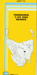
This Topographic Map is produced by the Department of Primary Industries, part of the Tasmanian Government.
These maps are an important resource for Government, industry, and the public. They are used for environmental and emergency management, farm planning and mineral exploration. They are also popular for recreational users such as bushwalkers, mountain bike and horse riders.
The PDF version of this can be printed at home or sent to a professional printer for a 100% scale reproduction.
At this scale, 4cm on this map represents 1km on the ground. A standard map (which is square) covers an area of approximately about 12.5km by 12.5km, with a contour interval of 10m. This map contains natural and constructed features including road and rail infrastructure, vegetation, hydrography, contours, localities and some administrative boundaries.
Allround Hill Badger Spur Blowfly Island Bucks Marsh Cradle Hill Devils Throat Frog Hill Hatchery Shore Hurricane Opening Inchies Gully Lagoon Plain Lake Sorell Micks Creek Mount Franklin Mount Penny Mountain Creek Murdochs Point Paradise Hill Powells Bay Robertsons Bay Robertsons Marsh Shepherds Shore Sheridans Corner St Georges Island Tods Hill Woods Lake Dam Cradle Marsh Jemmys Back Long Marsh Robertsons Marsh Conservation Area Sharmans Corner The Island The Sand Badger Hill Tod Hill Lake Sorrel
| Title | Pdf Download |
|---|