TAS 5032 – Table Discount
- Estimated Delivery : Up to 4 business days
- Free Shipping & Returns : On all orders over $200
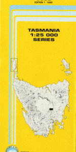
This Topographic Map is produced by the Department of Primary Industries, part of the Tasmanian Government.
These maps are an important resource for Government, industry, and the public. They are used for environmental and emergency management, farm planning and mineral exploration. They are also popular for recreational users such as bushwalkers, mountain bike and horse riders.
The PDF version of this can be printed at home or sent to a professional printer for a 100% scale reproduction.
At this scale, 4cm on this map represents 1km on the ground. A standard map (which is square) covers an area of approximately about 12.5km by 12.5km, with a contour interval of 10m. This map contains natural and constructed features including road and rail infrastructure, vegetation, hydrography, contours, localities and some administrative boundaries.
Serat Largo Eaglehawk Gully Back Forest Tier Bag Hut Creek Belles Creek Belles Marsh Ben Browns Hill Black Marys Hill Black Snake Creek Boathouse Shore Boggy Marsh Bullys Marsh Burdetts Flat Bushrangers Creek Dinner Marsh Flat Iron Hill Flynns Flat Forest Marsh Glenview Sugarloaf Good Marsh Hut Run Hill Jacks Point Jacksons Scrub Legs o Man Flat Little Jones Lookout Long Arm Spur Mount Serat Neils Hill Notuck Hill Old Mans Head Old Womans Head Sarahs Waterfall Sawpit Hill Table Mountain Table Mountain Conservation Area Table Mountain Shore Tent Marsh Tiger Cat Gully Tiger Rise Tiger Rise Conservation Area Waterfall Spur White Kangaroo Hill Wild Pig Tier Young Mans Head Belles Hill Big Bay Bushrangers Gully Clear Hill Coal Hill Junction Creek Old Man Head Mike Howes Marsh
| Title | Pdf Download |
|---|