TAS 4224 – Solitary on Sale
- Estimated Delivery : Up to 4 business days
- Free Shipping & Returns : On all orders over $200
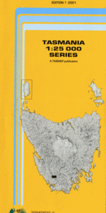
This Topographic Map is produced by the Department of Primary Industries, part of the Tasmanian Government.
These maps are an important resource for Government, industry, and the public. They are used for environmental and emergency management, farm planning and mineral exploration. They are also popular for recreational users such as bushwalkers, mountain bike and horse riders.
The PDF version of this can be printed at home or sent to a professional printer for a 100% scale reproduction.
At this scale, 4cm on this map represents 1km on the ground. A standard map (which is square) covers an area of approximately about 12.5km by 12.5km, with a contour interval of 10m. This map contains natural and constructed features including road and rail infrastructure, vegetation, hydrography, contours, localities and some administrative boundaries.
Barrier Islands Bluff Tarn Bonnet Bay Buckies Bonnet Cawthorn Island Cleft Peak Companion Range Coronets Shore Cripps Point Croaking Lake Crumbledown Crumbledown Shore Forest Creek Frankland Peak Frankland Range Frankland Saddle Frankland Shore Greycap Groombridge Point Johnstones Lookout Kostka Point Lake Pedder Lora River Madonna Ridge Mount Cawthorn Mount Lloyd Jones Mount Solitary Murphys Bluff Pedder Reach Pennies Shore Redtop Peak Remote Peak Sanctuary Lake Secheron Peak Swampy Creek Terminal Peak The Citadel The Coronets The Cupola The Lion The Moat Timber Creek Lake Pedder National Park Terminal Passage South-West National Park Serpentine Dam Lake Maria Gordon Dam Lake Gordon Scotts Peak
| Title | Pdf Download |
|---|