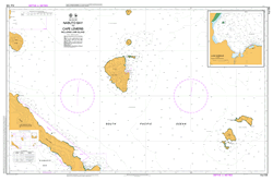
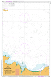
PNG 539 – Nabuto Bay To Cape Lemeris Including Lihir Island Supply
- Estimated Delivery : Up to 4 business days
- Free Shipping & Returns : On all orders over $200
This official Nautical Chart is produced by the Australian Hydrographic Office, and corrected fortnightly to Notice to Marines by Cairns Charts & Maps. This ensures it remains compliance with Safety of Navigation requirements. This marine chart, or sea map , is primarily produced to support the safe navigation of commercial shipping through Australian, Papua New Guinea and Solomon Island waters.
Nautical charts depict the seabed, or bathymetry, using a variety of colours to shade the depth regions. Darker blues indicate shallower water, while light blues and white indicate deeper water. A chart will also show continuous contour lines (at varying intervals depending on the scale of the chart), spot depths across the whole area, as well as different symbols indicating wrecks, shallow rocks and dangers, as well as details on lights, light houses, tides and currents.
For extensive detail on the symbology of nautical charts, the Symbols and Abbreviations used on Admiralty Charts is the definitive reference.
Wurtol Mount Wanwangar Wang Tuorong Tumundar Tuital Creek Ton Taun Tombavil Tiriwan Trewon Tes Tamat Reef Teriteri Number 2 Teri-Teri 2 Teriteri Number 1 Teri-Teri 1 Tereri Plantation Tefa Island Tefa Tefa Mission Taunsip Taonsip Taubie Taubi Tanga Islands Anthony Caens Anthony Caens-Inseln Anthony Kaan Island Ile d Oraison Ile dOraison Kaan Islands Oraison Island Oraison-Inseln Tanga Group Tanga Inseln Tanga-Gruppe Tanga Tanandon Creek Talis Tabar Island Surupu Plantation Suntaufi Point Sunkin Sungkin Summiul Island Sunmiul Suen Suein Tsuen Soalaba River Smith Cape South Cape Sinikima Sinaudo Sinaudu Silom Number 2 Silom 2 Silom Number 1 Silom Silom 1 Sianus Shiar Selimun Sasa Saru Plantation Karumut Plantation Kurumut Plantation Sarakub Sanambiet Island San Bruno Sanambir Island Samo Number 2 Samo 2 Samo Number 1 Samo Samo 1 Salupkup River Salkangkis Salik River Sali Sale Rumarik Creek Romantische Bay Banesa Bay Romantic Bay Rasese Rapalbe Reef Rangelis Plantation Suma Plantation Ramat Plantation Ramut Plantation Ramat Bay Ramat Putput Point Putput Number 2 Put Put 2 Putput Number 1 Put Put 1 Putput Put Plantation Put-Nonu Plantation Put Pukimano Pubanum Creek Potumbaru Island Pire Pindik Point Penaris School Penapedik Taraguan Mission Penamun Pango Panatgin Plantation Panatgin Penatgin Palie Numbu Nubil River Nonu Plantation Nekin Island Natlu Island Cape Nasan Cape Nasen Namatanai ATN Namatami Namatani Namatania Namatano Namatenei Cape Namarodu Cape Mamarodu Cape Mamorodu Cape Marorodu Cape Namaroda Malum Point Namarodu Nabuto Bay Musoi Mumu Island Morai Mi River Merabaubau Creek Merabaubau Matlik Bay Matalik Bay Matilik Bay Matlik Matatukuen Matuken Matakues Mataguis Matakan River Matadaragum River Masahet Island Massait Saint Joseph San Joseph Maoawumbaru Island Mang-Gawur Manggawar Mali Island Malie Island San Antonio Malesak Malendok Island Malal Mahur Island Mahuri Island Maur San Francisco Mabua Mabua Mission Mapua Luvish Plantation Lumburu Point Lumburu Luise Harbour Lubun Luanke Luangki Londolovit River Londolovit Plantation Londolowit Plantation Londolovit LNV Loloba Lokon Plantation Bulu-Logon Plantation Lokon Lisel Liasel Lissel Linmel Linmal Lililigin Lihir Island Gardeney Gardenijs Gerrit Denys Island Gerrit de Nijs Ile du Bouchage Lir Island Lihir Group Lif Island Lienbil Lenbil Liebliche Bay Lieblieche Bay Libuko Lipokok Lemeris School Mandak School Lemeris Creek Cape Lemeris Kap Lemeris Lemeris Lelet Plateau Lataul Langgamut Lamboa Lamban Bay Lake Kenham Bay Lakakot Passage Lagagot Bay Lalagot Bay Labur Bay Labur Kurumut Number 2 Kurumut 2 Kurumut Kunidolam River Kunaiya Kunaie Kuelam Korodak Aid Post Koriesu Mission Kono Number 2 Kono Number 1 Kono Konogogo Konobio Plantation Konebio Plantation Cape Kono Konmiap Konmakio Kominasaeo Kamunaseo Komat Komalu Plantation Komalu Bay Komalu Komoles Komolus Komalabu Kolonoboi River Kolonoboi Mission Kolonoboi Kolanaboi Kolonubo Kokola Plantation Kokota Plantation Kokola Koko Bay Koko Kobi Kitkita Angkitkita Kisiu Kinami Kiata Kiam Kenapit Plantation Kela Creek Kawambu Katingan Aid Post and Mission Katingan Aid Post Mission Katingan Karu Plantation Karu Bay Karu Kaguso Kanapit Kenapit Kanam River Kanam Plantation Kanam Mission Kanam Kanabu Kanambu Mount Kambari Kamale Plantation Komale Plantation Kalom Kalawanamugu Kalagunan Point Kalagunan Kabin Huniho Gunari Gosmaium Gogo Gitarut Gargaris Cargaris Gagaris Fonli Funli Fangwel Fang Dononang River Derimos Creek Datava Dataru Point Dataru Plantation Danolango River Dakabus Creek Dahana Dabinot Bulu Plantation Bulu Buka River Bopire Plantation Bombel Creek Bogolis Boang Island Boieng Island Bo Po Bitlik Island Bitkesinmer Island Bitkesingmer Island Bitkangkunmale Island Bitkenkumale Island Bitkenkumele Bitbok Island Bitdok Bilami Bilama Bil Belik River Belik Plantation Belik Belfamfal Belamfar Mount Beirari Barbarlau Barangas Point Banesa Banam Banan Banham Balanwaransau Belannarasua Bakan Plantation Cape Bakan Bakan Bakago Atlamau Ansawe Angfa Plantation Amfa Amfar Angfa Ambisumne Ampisunme Ambaba Aloinasan Rock Akebut River Namatanai Road Salimun Lihir Island Airport AYKY Boang BOV Koriesu
| Title | Paper, Flat Paper, Laminated |
|---|
