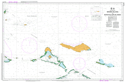
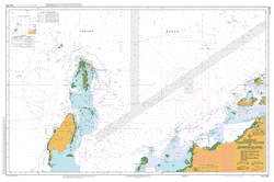
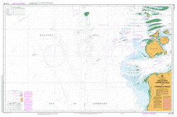
PNG 512 – Misima Island To Bonvouloir Islands Online now
- Estimated Delivery : Up to 4 business days
- Free Shipping & Returns : On all orders over $200
This official Nautical Chart is produced by the Australian Hydrographic Office, and corrected fortnightly to Notice to Marines by Cairns Charts & Maps. This ensures it remains compliance with Safety of Navigation requirements. This marine chart, or sea map , is primarily produced to support the safe navigation of commercial shipping through Australian, Papua New Guinea and Solomon Island waters.
Nautical charts depict the seabed, or bathymetry, using a variety of colours to shade the depth regions. Darker blues indicate shallower water, while light blues and white indicate deeper water. A chart will also show continuous contour lines (at varying intervals depending on the scale of the chart), spot depths across the whole area, as well as different symbols indicating wrecks, shallow rocks and dangers, as well as details on lights, light houses, tides and currents.
For extensive detail on the symbology of nautical charts, the Symbols and Abbreviations used on Admiralty Charts is the definitive reference.
Wuri Wuri Passage West Passage Umoni Torlesse Islands Topuna Tinolan Island Strathord Islands South Passage South Pass Mount Sisa Mount Nogulenan Rokia Point Rijak Bay Bunama Bay Renard Islands Redlick Passage Redlick Islets Rara Island Pearce Patch Patnai Passage Island Panawadai Islet Pana Wadai Pana Uya Wana Island Pannauya Wana Island Pana Sagu Sagu Islet Pana Roran Islet Panarakuum Island Panarakiim Panapompom Island Pananiu Island Pana Niu Panamaiia Island Reef Island Deboyne Island Panaeati Island Panaete Island Panniet Island Oreia Islet Oreia Island Nivani Island Niva Beno Islet Nivabeno Island Nirut Nibub Islet Nibub Island Muniara Island Misima Island Ile Misima MIS Saint Aignan Island Misima District Managun Islet Managon Island Mabui Islet Mabui Island Lunn Island Liak Liag Leiga Island Lalama Larama Mount Koia Tau Mount Oia-Tau Kimuta Island Kaubwaga Kaubagga Kaubbagga Kawbwagga Kamatal Islet Kamatal Island Isu Raua Raua Island Isu-Raua-raua Horaki Raki Passage Enauta Hinaula Hinauta Cape Henry Hastings Island Gumai An Island Gulewa Gigira Islet Gegila Islet Gigira Island Ewena Ewina Epoko Islet Epoko Island Eligan Point Cape Ebora Cape Ebola Eaus Eiaus Eihaus Eihous East Island Deboyne Lagoon Deboyne Atoll Deboyne Islands Debagarai Passage Debagarai Pass Bwagaoia Bugoiya Bwagaoio Bushy Islets Bunora Islet Bunora Island Bonvouloir Islands and Reefs Bonvouloir Islands Bonna Bonnawan Bonna-bonnawan Island Basses Islands Basses Island Baiwa Islet Point Bagga Bagga Bagai Um Islet Auriroa Island Aroroa Island Alhoga Alhoka Aiwa Buna Reef Aba Evara Islet Abaevara Island Rerihol Island Losai Island Nibub Passage Nibub Pass Ebora Boniao Manghuna Sagara Tenoklamana Lagira Bwagaoia Harbour Nivani Passage Misima Island Airport AYMS Aeroport de l Ile Misima Weslayan Mission Panaeati Bagalina Loaga Haliba Barmatana North Island Panomole Island Amatuna Island Middle Island Bugojya
| Title | Paper, Flat Paper, Laminated |
|---|
