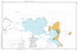
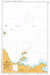
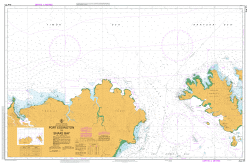
PNG 516 – Trobriand Islands To Lusancay Islands For Cheap
- Estimated Delivery : Up to 4 business days
- Free Shipping & Returns : On all orders over $200
This official Nautical Chart is produced by the Australian Hydrographic Office, and corrected fortnightly to Notice to Marines by Cairns Charts & Maps. This ensures it remains compliance with Safety of Navigation requirements. This marine chart, or sea map , is primarily produced to support the safe navigation of commercial shipping through Australian, Papua New Guinea and Solomon Island waters.
Nautical charts depict the seabed, or bathymetry, using a variety of colours to shade the depth regions. Darker blues indicate shallower water, while light blues and white indicate deeper water. A chart will also show continuous contour lines (at varying intervals depending on the scale of the chart), spot depths across the whole area, as well as different symbols indicating wrecks, shallow rocks and dangers, as well as details on lights, light houses, tides and currents.
For extensive detail on the symbology of nautical charts, the Symbols and Abbreviations used on Admiralty Charts is the definitive reference.
Yaona Island Yalaka Yalaki Wagwama Bay Wagalasa Island Wagalaso Island Wadana Islet Wadana Island Vakuta Island Vakuta Uratu Islet Nurutu Island Uratu Island Tuma Island Trobriand Islands Kiriwina Islands Towai Point Tawai Point Taiagaina Bay Taiagina Bay Tabuia Point Susua Point Simsim Island Simlindon Island Sinlindon Silipwaka Island Siliniaka Island Silipuaka Sia Islet Sia Island Rothwell Bank Polaris Patches Osikwea Sikwea Okupukopu Creek Obulaku Obulaka Oburaka Nukuana Island Nubiam Island Nuarguta Island Nauria Island Nanauli Island Nanaula Island Nakwaba Island Muwo Island Mu-Ua Island Munuwata Island Nauta Island Nuata Island Muiau Bay Muaio Bay Muiao Bay Moligilagi Moligilaga Miligui Point Matagu Island Mamamada Point Mamada Point Magulata Point Lusancay Islands and Reefs Lusancay Group Lusancay Islands Lusangay Islands and Reefs Lulima Island Losuia LSA Lobua Creek Labi Island Kwaibwaga Kuia Kuiao Island Kuiau Kuiaua Kuiawa Kuyau Island Kumkwalaga Bay Kumkuri Point Kuluvitu Kuluritu Kuaniagal Island Koseikwa Point Kosesikwa Point Konokonowana Island Konokonwana Koma Kobatara Point Kitava Island Nowan Island Nowau Island Kiriwina Island Trobriand Island Kiriwana Kibu Island Kawa Island Kasilamaka Passage Kasilamaka Pass Karakuba Point Kanapu Island Kanapo Kaileuna Island Kaibola Kaduwaga Kadawaga Kadnwaga Kudawaga Kuduwaga Kadataiveakwa Point Kadalaiveakwa Point Kadalawa Point Kadai Island Kabwao Point Kabuluna Point Kabanikau Point Kabunikau Point Kabanakwaikwala Point Kabunakwaikwala Point Idateka Point Bugeew Point Bugeewa Point Idaleka Point Ialaka Iaga Island Laga Island Yaga Island Gwadarab Island Gimwa Bay Gunwa Bay Gilua Island Gilibwa Giriba Glibu Gabwina Island Gadwina Island Dukuboi Point Deia Island Buriwadi Island Bomatu Point Bamatu Point Cape Denis Bomapau Island Baimapu Island Illasasa Boli Point Boitalu Beitalu Boinagi Island Boimagi Island Boimago Island Boingi Island Bodela Losuia Airport AYKA Lifaba Island Ogigiku Nucuayayu Islets Kudalabi Island Ebuna Island Konia Kwaiyaluma Island Tukwaukwa Okukwewelou Kiriwina Goodenough Kiriwina Goodenough District Kiriwina-Goodenough Kiriwina-Goodenough District Adina Chippendale Qt Sydney Radisson Blu Plaza Hotel Pullman Sydney Hyde Park Adina Sydney Park8 Hotel The Castlereagh Park Regis Concierge Cremorne Travelodge Phillip Street Mercure Sydney Potts Point Pier One Sydney Harbour Autog Seasons Darling Harbour Adina Central Best Western Plus Stellar Mercure International Airport
| Title | Paper, Flat Paper, Laminated |
|---|
