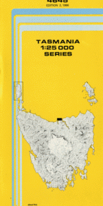
TAS 4645 – Greens Beach For Sale
- Estimated Delivery : Up to 4 business days
- Free Shipping & Returns : On all orders over $200
This Topographic Map is produced by the Department of Primary Industries, part of the Tasmanian Government.
These maps are an important resource for Government, industry, and the public. They are used for environmental and emergency management, farm planning and mineral exploration. They are also popular for recreational users such as bushwalkers, mountain bike and horse riders.
The PDF version of this can be printed at home or sent to a professional printer for a 100% scale reproduction.
At this scale, 4cm on this map represents 1km on the ground. A standard map (which is square) covers an area of approximately about 12.5km by 12.5km, with a contour interval of 10m. This map contains natural and constructed features including road and rail infrastructure, vegetation, hydrography, contours, localities and some administrative boundaries.
Badger Beach Badger Head Black Reef Copper Cove Friend Point Greens Beach Greens Beach Conservation Area Greens Beach Golf Course Hebe Reef Middle Channel Nudists Beach Pebble Beach Sea Hill Wentworth Hill West Head West Reef Asbestos Range Conservation Area Boobyalla Bay First Little Beach Shoal Bay The Punchbowl Point Flinders Boobyalla Stockyard Hills
| Title | Pdf Download |
|---|